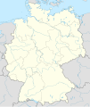
File:Germany, Federal Republic of location map October 1949 - November 1950.svg

Original file (SVG file, nominally 1,075 × 1,273 pixels, file size: 501 KB)
Captions
Captions
Summary[edit]
| DescriptionGermany, Federal Republic of location map October 1949 - November 1950.svg |
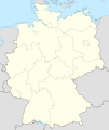
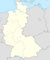
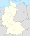
Deutsch: Positionskarte der Bundesrepublik Deutschland. Diese Karte zeigt die Bundesrepublik im Gebietsstand zwischen Oktober 1949 bis November 1950.
Quadratische Plattkarte, N-S-Streckung 150 %. Geographische Begrenzung der Karte:
English: Location map of Federal Republic of Germany. Map shows West-Germany as of October 1949 bis November 1950.
Equirectangular projection, N/S stretching 150 %. Geographic limits of the map:
|
||
| Date | Created in 2009 | ||
| Source | own work, based on File:Germany location map.svg | ||
| Author | TUBS | ||
| Permission (Reusing this file) |
I, the copyright holder of this work, hereby publish it under the following licenses:
This file is licensed under the Creative Commons Attribution-Share Alike 3.0 Unported license.
You may select the license of your choice. |
||
| Other versions |
Bundesrepublik Deutschland (vor 1990 nur West-Deutschland):
Deutsche Demokratische Republik (mit BRD im Ausschnitt):
Ostdeutschland (vor 1990 Deutsche Demokratische Republik):
Deutschland zwischen Mai 1945 und Oktober 1949:
Thematisch:
Deutsches Reich (1918–1945) (best used with this template (de)):
|
File history
Click on a date/time to view the file as it appeared at that time.
| Date/Time | Thumbnail | Dimensions | User | Comment | |
|---|---|---|---|---|---|
| current | 14:47, 16 September 2013 |  | 1,075 × 1,273 (501 KB) | NordNordWest (talk | contribs) | Reverted to version as of 08:35, 16 September 2013; your are destroying the location map template function |
| 12:43, 16 September 2013 |  | 927 × 1,274 (679 KB) | SokoWiki (talk | contribs) | Saarland was not part of the Federal Republic of Germany until 1957 and Berlin was not until 1990. | |
| 08:35, 16 September 2013 |  | 1,075 × 1,273 (501 KB) | NordNordWest (talk | contribs) | Reverted to version as of 22:13, 15 September 2013 | |
| 22:37, 15 September 2013 |  | 927 × 1,274 (679 KB) | SokoWiki (talk | contribs) | Reverted to version as of 20:00, 15 September 2013 | |
| 22:13, 15 September 2013 |  | 1,075 × 1,273 (501 KB) | TUBS (talk | contribs) | Reverted to version as of 19:15, 22 January 2009 | |
| 20:00, 15 September 2013 |  | 927 × 1,274 (679 KB) | SokoWiki (talk | contribs) | * | |
| 19:15, 22 January 2009 |  | 1,075 × 1,273 (501 KB) | TUBS (talk | contribs) | == {{int:filedesc}} == {{Information |Description= {{de|Positionskarte der Bundesrepublik Deutschland. Diese Karte zeigt die Bundesrepublik im Gebietsstand zwischen Oktober 1949 bis November 1950.}} Quadratische Plattkarte, N-S-Strecku |
You cannot overwrite this file.
File usage on Commons
The following 28 pages use this file:
- File:Deutschland Autobahnen.svg
- File:East-West-Germany-October 1949-July 1952.svg
- File:East Germany location map.svg
- File:Germany, Federal Republic of location map 23 May 1949 - 6 Oct 1949.svg
- File:Germany, Federal Republic of location map April 1952 - August 1955.svg
- File:Germany, Federal Republic of location map December 1950 - April 1952.svg
- File:Germany, Federal Republic of location map January 1957 - October 1990.svg
- File:Germany, Federal Republic of location map October 1949 - November 1950.svg
- File:Germany, Federal Republic of location map September 1955 - December 1956.svg
- File:Germany, German Democratic Republic location map January 1957 - October 1990.svg
- File:Germany, German Democratic Republic location map July 1952 - January 1957.svg
- File:Germany, German Democratic Republic location map October 1949 - July 1952.svg
- File:Germany, German Democratic Republic location map w·o FRG July 1952 - October 1990.svg
- File:Germany, German Democratic Republic location map w·o FRG October 1949 - June 1952.svg
- File:Germany, location map (SBZ perspective) 23 May 1949 - 6 Oct 1949.svg
- File:Germany2 location map.svg
- File:Germany location map.svg
- File:Germany location map 23 April 1949 - 22 May 1949.svg
- File:Germany location map 8 Jun 1947 - 22 Apr 1949.svg
- File:Germany location map April 1992 - July 1992.svg
- File:Germany location map August 1992 - June 1993.svg
- File:Germany location map July 1993 - December 2009.svg
- File:Germany location map October 1990 - March 1992.svg
- File:Germany location map labeled 8 Jun 1947 - 22 Apr 1949.svg
- File:Lage Freiberg in Deutschland.png
- File:Relief Map of Germany.png
- File:Relief Map of Germany.svg
- Template:Germany location map/other versions
File usage on other wikis
The following other wikis use this file:
- Usage on de.wikipedia.org
- Usage on fi.wikipedia.org
- Usage on no.wikipedia.org
- Usage on pl.wikipedia.org
- Usage on pl.wikibooks.org
- Usage on pt.wikipedia.org
- Usage on ru.wikipedia.org
- Usage on zh-yue.wikipedia.org
Metadata
This file contains additional information such as Exif metadata which may have been added by the digital camera, scanner, or software program used to create or digitize it. If the file has been modified from its original state, some details such as the timestamp may not fully reflect those of the original file. The timestamp is only as accurate as the clock in the camera, and it may be completely wrong.
| Width | 1075.227 |
|---|---|
| Height | 1272.9 |







_23_May_1949_-_6_Oct_1949.svg/101px-Germany%2C_location_map_(SBZ_perspective)_23_May_1949_-_6_Oct_1949.svg.png)




_location_map.svg/101px-Germany_(+districts)_location_map.svg.png)
_location_map_2013.svg/102px-Germany_(+districts_+municipalities)_location_map_2013.svg.png)


